


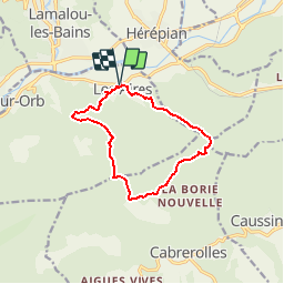
34 - Les Aires - St Michel de Mercoirol - Les monts d' Orb - Pic de la Coquillade - 11,3 km - 4h00.gpx

dansmabulle34
User

Length
11.3 km

Max alt
701 m

Uphill gradient
578 m
Km-Effort
19 km

Min alt
186 m

Downhill gradient
579 m
Boucle
Yes
Creation date :
2015-04-18 00:00:00.0
Updated on :
2015-04-18 00:00:00.0
3h59
Difficulty : Medium

FREE GPS app for hiking
 SityTrail
IGN / Geographical institutes
SityTrail Plus
The world is yours!
About
Trail Walking of 11.3 km to be discovered at Occitania, Hérault, Les Aires. This trail is proposed by dansmabulle34.
Positioning
Country:
France
Region :
Occitania
Department/Province :
Hérault
Municipality :
Les Aires
Location:
Unknown
Start:(Dec)
Start:(UTM)
508398 ; 4825482 (31T) N.
Comments